Facts and figures
Climate and landscape
Mbarara district receives an average annual rainfall of 1,200mm with two rainy seasons, during the months of February-May and September-December. Temperature ranges between 170C to 300C, with a humidity range of 80-90%. The topography is a mixture of fairly rolling and sharp hills and mountains, shallow valleys and flat land. The soils are generally sandy, clay and slightly laterite loams, suitable for cultivation.
Location
Mbarara is the administrative capital of southwestern Uganda. The district boarders Ibanda and Kiruhura Districts to the north; Mbarara City to the east; Mbarara City to the south; Sheema and Buhweju Districts to the west. The district headquarters is located 270 kilometers (170 miles), by road, southwest of the capital city, Kampala.
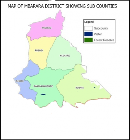
Mbarara District is comprised of one County (Kashari) with two constituencies( Kashari North and South). The District has six sub counties namely: Rubindi, Bubaare, Bukiro, Kashare, Kagongi and Rubaya Sub Counties. Mbarara District has five Town Councils namely: Bwizibwera - Rutooma, Rwanyamahembe, Bukiro, Rubindi-Ruhumba and Nyabisirira Town Councils.